Footsteps – The Canals
The Swansea valley canal
Allied to the development of industry in the Tawe and Neath valleys were the canal networks. In the late 18th century the canals carried the coal, iron, stone, and copper down the valleys. There remain three canals within 2-4 miles of the cottages. Now these canals provide miles of easily accessed paths. These are popular walks and regularly used for recreation by dog walkers, cyclists and ramblers. They are tranquil places to stroll along, listening to birdsong and observing nature. It is easy to forget the importance of the waterways in bygone times. This identifies footpaths and footways next to canals close to Tan yr Eglwys Cottages
The Swansea Valley canal travels through Pontardawe. Originally it flowed from Ystalyfera down to Swansea docks, almost 17 miles in length. Now these canals provide miles of easily accessed paths. These are popular walks and regularly used for recreation. by dog walkers, cyclists and ramblers.
The canal no longer flows to Swansea. It now starts at Godregraig, just two and a half miles north of Pontardawe and it ends south of Clydach. The total length of the canal is now only 6 miles and the canal is no longer navigable by barges. You can hire canoes or kayaks in the Summer at Coedgwilym Park.
The Neath and Tennant canals.
Two canals pass through Neath, the Neath canal and the Tennant canal. The first travels to Briton Ferry and the other reaches Swansea. More footpaths and footways next to canals close to Tan yr Eglwys Cottages
The Neath Canal
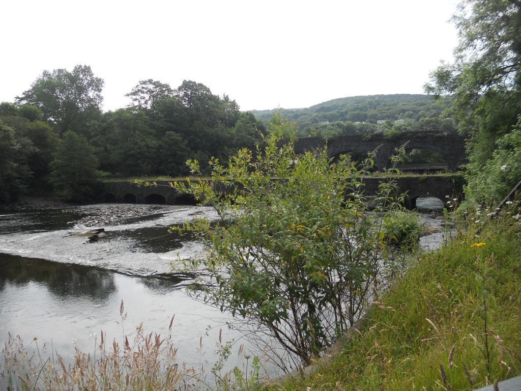
Being in close proximity to the tidal Neath Estuary, large 60 ton barges accessed the canal from the river Nedd. Neath, the valley and surrounding areas had involvement in many significant achievements. Steam engines used in the railway, shipping and mining industries were manufactured at the Neath Abbey Ironworks. The high pressure steam engine designed by Richard Trevithic was developed in the Ironworks at the top of the Neath valley. Some of the cannons used in the Napoleonic War were produced in Neath abbey Ironworks.
The Neath canal begins up at Glynneath and is just over 12 miles in length down to Briton Ferry. The Neath canal path has been upgraded recently and is now part of Sustrans route 47. The walk from Glynneath to Neath is picturesque. A shorter option is start at Aberdulais. It is usually easy to park in a long lay by near to the Aberdulais Tin Works and Falls, a National Trust site of interest which has a few simple facilities: coffee, toilets, tourist info and gifts. The tourist information gathered there will assist in the further understanding of the area. By explaining the history and the need for transportation, the importance of these respective waterways to the industries of the Neath valley becomes apparent.
At Aberdulais the Neath and Tennant canals meet and if having walked from Neath on the Tennant canal, here is an opportunity to cross over to the Neath canal and walk up towards Glyn Neath (8 miles away), or return down to Neath on the Neath canal.
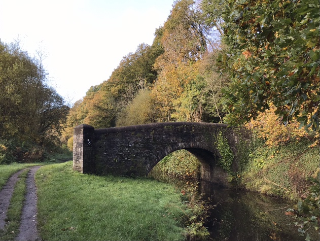
Bridges near Aberdulais
There is a small area of land around Aberdulais where there are more bridges than any other similar sized area in the UK! These bridges are the many crossings of rivers & roads in the area. There are also 2 canals in the Aberdulais area. Some of the bridges in this area are railway bridges and a 130 metre long aquaduct carrying the Tennant canal over the river. Within the Nat Trust site are the remains of a bridge for trams. At the Aberdulais Basin is Pont Gam, which translates as the crooked bridge or Skew Bridge. The latest bridge to be constructed is the modern bridge created to carry the fast A465 dual carriageway down the Neath valley that serves as a route to connect the Midlands to Neath and Swansea.
Aberdulais to Neath is a distance of only 2 miles. I have always enjoyed walking this section. At Aberdulais it is easy to park your car. From there you can walk down the Neath canal to Neath. Where you will pass many bridges. Eventually the canal path leads into the countryside. Nearby is the ancient church of St. Illtyd’s. On the approach to Neath you realise that what you had previously believed to be roadside cottages and houses, they enviously have gardens that back down onto the canal.
There are several low bridges to pass under. Some of the bridges are covered in graffiti. The Quaker House and Neath Castle are near enough for a quick visit. It is easy to find a cafe with character, Moruzzi’s is very near to Morrison’s and worth asking for directions. Consider returning onto the far end of Bridge Street and join the Tennant canal to walk back to Aberdulais.
The Tennant Canal
This canal runs a total of about 9 miles from Aberdulais down to Port Tennant on the east side Swansea. If a shorter taster walk is wanted, with added interest, then park at Neath Abbey ( behind the Tesco Store at the Neath Abbey / Neath roundabout, near to the M4 exit sliproad roundabout. Parking there is free and the Neath Abbey ruins will probably impress sufficiently to spend some time there – before or after a canal walk. It is 3.5 miles from the Abbey to Aberdulais.
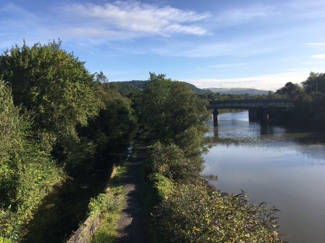
After a mile the canal crosses the edge of Bridge St in Neath town centre. It is worth walking onto the old Neath river Bridge to look North. Note the proximity of the Tennant canal on the left side, near the freight branch railway, then the wide tidal Neath river and to its right is the Neath Canal
South of Neath Abbey, the canal passes through a far more rural and tranquil area. The canal travels through Pant y Sais Nature Reserve and then onto Crymlyn Bog to the west. This is a very large lowland fen with extensive reed beds, it is a haven for wetland plants, birds and insects.